




When I took Master Gardener classes a few years ago, we looked at soil maps that plotted the soil type in our county. What I found fascinating is how accurate it was. Romie and I had remarked once how you could dig a hole to plant a tree in one part of the yard and just 20 feet away, the soil was entirely different. One was heavy, mucky clay, and the other was noticeably less sticky.
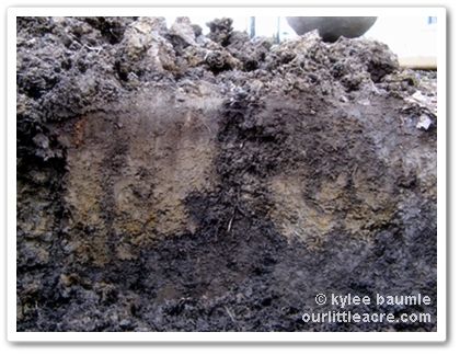 |
| If you have clay soil, you'll recognize this! |
A friend of mine shared a website earlier today on Facebook that looked intriguing, so I thought I'd share it with you. Kelly posted a link to FarmLogs, a website intended to be an aid to farmers, but we're farmers, right? We grow food and other things that need soil.
When you enter your address, you'll see a satellite photo of your property. Then you draw a line around the boundary of that property. The site then shows you a "map" of the specific soil type for that land. There's other helpful information given too, such as rainfall amounts for the last 24 hours, the last week, and the year-to-date.
Here's my soil map:
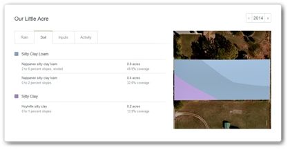
Our two types of soil are:
- Nappanee Silty Clay Loam - The Nappanee series consists of very deep, somewhat poorly drained soils that are moderately deep or deep to dense till. They formed in clayey till on wave-worked till plains, till-floored lake plains, till plains, and moraines.
- Hoytville Silty Clay - The Hoytville series consists of very deep, very poorly drained soils that are deep or very deep to dense till. They formed in till that has been leveled by wave action and are on lake plains.
Yes, that's right - clay soil that doesn't drain very well. I didn't need a soil map to tell me that, but it's still interesting all the same!







 "Bejeweled"


